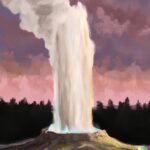
Volcanic eruptions are a force of nature that can have devastating consequences, from ash clouds to lava flows. In order to mitigate these risks, scientists have developed methods to predict when a volcano might erupt. By monitoring seismic activity, ground deformation, gas emissions, thermal changes, and satellite imagery, experts can better anticipate volcanic activity.
Predicting eruptions is not without its challenges, such as the unpredictable nature of volcanoes and limited technology. Despite these obstacles, advancements in monitoring techniques, satellite technology, and artificial intelligence hold promise for the future of volcanic eruption prediction.
What Are Volcanic Eruptions?
Volcanic eruptions are natural phenomena that occur when magma, gases, and rocks are expelled from the Earth’s crust through openings in the surface known as volcanoes.
These eruptions can be triggered by various factors such as tectonic plate movements, leading to the buildup of pressure underground. Before an eruption, there are often seismic activities, indicating the movement of magma beneath the surface.
Monitoring these seismic signals, along with other data like gas emissions and ground deformation, plays a crucial role in predicting volcanic eruptions. By analyzing such data, scientists can provide early warnings to communities living near volcanoes, helping to mitigate the impact of these powerful natural events.
What Are The Types Of Volcanic Eruptions?
There are two primary types of volcanic eruptions: explosive eruptions and effusive eruptions, each characterized by distinct mechanisms and outcomes.
Explosive Eruptions
Explosive volcanic eruptions involve the sudden release of pressurized gases and magma, resulting in violent explosions that can eject ash, rocks, and pyroclastic flows.
These eruptions are characterized by their potential to cause widespread devastation, posing significant risks to nearby populations and infrastructures. Seismic data plays a crucial role in monitoring the behavior of volcanoes, providing insights into the movement of magma beneath the surface. By analyzing seismic signals, scientists can better understand eruption dynamics and the likelihood of a volcanic event.
This information is essential for the development of early-warning systems, enabling authorities to evacuate at-risk areas and implement disaster preparedness measures. Through risk assessment and forecasting techniques, communities can better prepare for the impacts of future explosive eruptions.
Effusive Eruptions
Effusive volcanic eruptions involve the relatively gentle outpouring of lava, gases, and volcanic materials, creating lava flows and volcanic cones over time.
These eruptions are characterized by fluid lava that flows steadily, often without explosive activity. The magma involved in effusive eruptions tends to have low viscosity, allowing it to travel longer distances before solidifying. Gas emissions during these eruptions are typically less intense compared to explosive eruptions, manifesting as gentle puffs of steam and gases. Monitoring systems for effusive eruptions often rely on remote sensing technologies and geophysical observations to track changes in lava flow patterns and eruption dynamics.
How Are Volcanic Eruptions Predicted?
Predicting volcanic eruptions involves the analysis of various geophysical signals and data such as seismic activity, ground deformation, gas emissions, thermal monitoring, and satellite imagery to forecast potential volcanic events.
- Monitoring systems play a crucial role in this predictive process, as they continuously gather real-time data from active volcanic sites. Geophysical instrumentation, like seismometers and GPS devices, provides valuable insights into the internal processes of volcanoes, aiding in the identification of precursor signals.
- By applying statistical analysis to these datasets, experts can detect patterns and trends that may indicate an impending eruption. Interdisciplinary collaboration among geologists, volcanologists, and meteorologists also enhances the accuracy of hazard prediction by integrating different perspectives and areas of expertise.
Seismic Activity
Monitoring seismic activity near volcanoes provides crucial insights into the movement of magma and potential eruption precursors, as seismic signals can indicate the build-up of pressure beneath the surface.
Through continuous monitoring, scientists can detect various types of seismic events such as volcanic tremors, long-period earthquakes, and harmonic tremors, each carrying unique information about the volcano’s activity.
Signal analysis techniques like time-series analysis, frequency analysis, and waveform analysis help in identifying anomalies in the seismic data.
By utilizing sophisticated algorithms, researchers can pinpoint patterns associated with volcanic unrest, assisting in the prediction of potential eruptions and the issuance of timely warnings to nearby communities.
Ground Deformation
Monitoring ground deformation using geodetic measurements such as GPS and satellite techniques helps track changes in the Earth’s surface near volcanoes, providing insights into magma movement and potential eruption scenarios.
These techniques play a crucial role in multi-parameter studies that involve monitoring various aspects such as seismic activity, gas emissions, and geothermal geysers. By analyzing the strain patterns and deformation events over time, scientists can better understand the dynamics of volcanic systems and make more accurate forecasts. Combining geodetic measurements with probabilistic models allows researchers to assess the likelihood of different eruption scenarios and improve early warning systems for volcanic hazards.
Gas Emissions
Analyzing gas emissions from volcanoes, including sulfur dioxide and other gases, through observations and infrasound monitoring helps assess volcanic activity and potential hazards associated with gas release.
Gas emission monitoring plays a critical role in volcanic hazard assessment, providing valuable insights into the behavior of active volcanoes. Gas spectroscopy techniques enable scientists to identify and quantify different gases, such as carbon dioxide, hydrogen sulfide, and water vapor, which are released during volcanic eruptions.
By studying the thermo-gas dynamics within volcanic systems, researchers can understand the processes leading to gas emissions and their potential impact on the environment. Ground-based monitoring stations and satellite observations track the movement and dispersion of gas plumes, aiding in the early detection of volcanic unrest and eruption precursors.
Effective risk communication based on these gas monitoring methods is essential for informing communities residing near active volcanoes about potential hazards and necessary safety measures.
Thermal Monitoring
Thermal monitoring of volcanic areas using infrared cameras and satellite technology helps detect changes in temperature, identify hotspots, and track ash plumes, providing insights into volcanic activity and potential eruptions.
This technology plays a crucial role in volcano prediction by enabling scientists to monitor thermal anomalies, which indicate the movement of magma beneath the surface. By analyzing these thermal patterns and conducting simulations based on the data collected, researchers can gain a deeper understanding of volcano dynamics and predict potential eruptions more accurately. Remote sensing techniques further enhance this process by allowing for continuous monitoring of volcanic regions from a safe distance, reducing the risks associated with fieldwork in hazardous environments.
Satellite Imagery
Utilizing satellite imagery from observatories and remote sensing platforms enables continuous monitoring of volcanic regions, allowing for the detection of surface changes, gas emissions, and volcanic unrest indicators.
This data serves as a critical tool for eruption forecasting, providing scientists with valuable insights into the evolving behavior of volcanoes. By analyzing changes in thermal patterns, gas compositions, and ground deformations observed through satellites, researchers can assess volcanic hazards and issue warnings to at-risk populations in a timely manner.
Advancements in machine learning and artificial intelligence have amplified the capabilities of satellite observations by automating the processing of vast amounts of data, improving the accuracy of real-time surveillance and monitoring efforts. Despite these advancements, challenges remain in mitigating uncertainties associated with volcanic activity prediction, highlighting the need for continued research and innovation in this field.
What Are The Advantages Of Predicting Volcanic Eruptions?
Predicting volcanic eruptions offers several advantages, including the establishment of early warning systems, better evacuation planning, and the ability to minimize damage and casualties from volcanic events.
By utilizing advanced technologies such as remote sensing and harnessing insights from geology, scientists can now detect subtle signs of volcanic activity well before an eruption occurs. This crucial early detection not only provides valuable time for authorities to implement public safety measures and evacuate at-risk populations but also allows for enhanced disaster response planning. Such proactive measures are essential for safeguarding communities living near active volcanoes and reducing the potential impact of volcanic hazards on both lives and infrastructure.
Early Warning System
An early warning system for volcanic eruptions can provide critical time for at-risk populations to prepare and evacuate, reducing the potential impact of volcanic hazards through timely risk assessment and communication.
- By integrating various components such as seismic monitoring, gas sensors, and satellite data, an effective warning system can detect precursory signs of volcanic activity. These systems help in predicting eruptions and issuing alerts to the public, aiding in decision-making processes during crises.
Public awareness campaigns play a crucial role in ensuring that communities understand the risks and know how to respond. Clear risk communication strategies, coupled with well-defined response plans, are essential for minimizing casualties and damage during volcanic events.
Evacuation Planning
Effective evacuation planning ahead of volcanic eruptions can save lives and reduce injuries by ensuring organized and timely evacuations of communities at risk from lava flows, ashfall, or pyroclastic flows.
It is crucial for communities to have clearly marked evacuation routes that are well-maintained and easily accessible in case of emergencies. Alongside evacuation routes, response plans should be established, detailing protocols for different eruption scenarios to ensure a swift and coordinated response.
The success of evacuation plans relies heavily on community engagement strategies, including education programs and communication channels that inform residents about the potential hazards and the importance of preparedness in safeguarding public safety.
Minimizing Damage
Predicting volcanic eruptions allows for proactive measures to minimize damage to infrastructure, agriculture, and the environment, enhancing overall preparedness and reducing the economic impact of volcanic disasters.
By understanding eruption dynamics and utilizing advanced monitoring technologies, scientists can provide early warnings of imminent volcanic activity, giving authorities and communities vital time to evacuate and implement emergency response plans.
Risk assessment methodologies play a crucial role in identifying vulnerable areas and populations, enabling targeted preparedness efforts to safeguard public safety.
Effective risk communication strategies help disseminate information, educate the public, and encourage community participation in disaster preparedness initiatives.
Post-eruption recovery efforts focus on rebuilding essential infrastructure, restoring livelihoods, and facilitating the rehabilitation of affected ecosystems.
What Are The Challenges Of Predicting Volcanic Eruptions?
While predicting volcanic eruptions is crucial for public safety, it poses challenges due to the unpredictable nature of volcanoes, limitations in technology and resources, and the occurrence of false alarms that can impact emergency response.
Geophysical instrumentation plays a vital role in monitoring volcanic activity, but the data collected can be complex and difficult to interpret accurately. The reliance on traditional methods of eruption prediction, such as seismic monitoring and gas emissions analysis, can lead to uncertainties in forecasting.
With the integration of machine learning algorithms, there is potential to improve the accuracy of eruption forecasts by analyzing large datasets and identifying patterns that may indicate an impending eruption. Operational difficulties, such as maintaining and calibrating the geophysical instruments, and the need for continuous monitoring pose significant challenges in effectively predicting volcanic eruptions.
Unpredictable Nature of Volcanoes
The unpredictable behavior of volcanoes, influenced by complex geological and magmatic processes, poses challenges for accurate eruption forecasting and risk assessment, requiring constant monitoring and assessment.
Researchers study statistical patterns of past eruptions to better understand volcanic behavior, looking for precursors such as increased seismic activity, gas emissions, and ground deformation. By analyzing these indicators, scientists aim to improve hazard prediction and mitigate the potential risks associated with volcanic activity. Ongoing research plays a crucial role in enhancing early warning systems and emergency preparedness in regions prone to volcanic eruptions.
Limited Technology and Resources
The limited availability of advanced technology, expertise, and resources for volcanic monitoring and research hinders accurate eruption prediction and real-time response capabilities, highlighting the need for enhanced capabilities and interdisciplinary approaches.
The challenges stemming from these technological limitations and resource constraints are further compounded by the dynamic nature of volcanic activities. Expertise plays a crucial role in interpreting signals such as gas emissions and monitoring phenomena like ash plumes.
Ground-based monitoring systems provide valuable data, but their coverage is often limited. Remote sensing technologies offer insights from a distance but require intricate calibration.
Multi-parameter studies integrating various data sources hold potential for more comprehensive predictive models, yet the integration process is complex and demanding.
False Alarms
False alarms in volcanic eruption prediction can lead to unnecessary panic, confusion, and resource allocation issues, underscoring the importance of refining monitoring techniques and risk assessment methodologies to reduce false alerts.
Inaccurate predictions can have far-reaching consequences beyond causing fear and chaos among the populace. They can significantly impact public trust in the monitoring systems and experts responsible for issuing warnings. False alarms can disrupt emergency response plans and evacuation procedures, potentially leading to a lack of preparedness when a genuine threat arises. This could potentially result in delays in crucial decision-making processes, hindering timely actions that are necessary to safeguard lives and infrastructure.
It is vital for scientists and authorities to leverage advanced technologies such as ground deformation monitoring and infrasound observations, coupled with effective crisis communication strategies, to mitigate the risks associated with false alarms in volcanic forecasting.
What Are The Future Developments In Volcanic Eruption Prediction?
The future of volcanic eruption prediction holds promising advancements in monitoring techniques, satellite technology, and the integration of artificial intelligence and machine learning algorithms for more accurate and timely forecasts.
These innovations are reshaping the way geologists and scientists analyze volcanic activities. By leveraging real-time observations from satellites, researchers can closely monitor changes in volcanic behavior, such as gas emissions, ground deformation, and thermal characteristics. Integrating this wealth of data with advanced predictive modeling allows for a more comprehensive understanding of volcanic processes. Through sophisticated statistical analysis, patterns and trends can be identified, enabling the anticipation of eruptions with greater reliability. These cutting-edge technologies offer new insights into early warning systems, potentially saving lives and minimizing the impact of volcanic disasters.
Improved Monitoring Techniques
Enhanced monitoring techniques incorporating state-of-the-art instrumentation and geophysical methods empower volcanologists to conduct in-depth examinations of volcanic behavior, enabling more precise eruption predictions and risk assessments.
Seismometers play a pivotal role in this surveillance, detecting subtle ground movements that indicate magma intrusion. Deformation events, such as inflation or deflation of the volcano’s surface, offer valuable insights into underground processes. Ground-based observations, complemented by remote sensing techniques like spectroscopy, provide a comprehensive view of gas emissions and volcanic activity. These advancements have also led to the development of early-warning systems that can alert authorities and nearby communities to potential volcanic hazards, mitigating risks and saving lives.
Advancements in Satellite Technology
Technological advancements in satellite systems and remote sensing capabilities enhance the monitoring of volcanic regions, enabling real-time observations, gas emission tracking, and ash plume detection for proactive eruption forecasting.
Satellite technology provides valuable insights into volcanic activity through the utilization of thermal monitoring to detect changes in temperature that may indicate magma movement. By combining this data with machine learning algorithms, scientists can analyze geodetic measurements to understand the deformation of the Earth’s surface caused by volcanic processes.
Satellite-based gas plume observations offer a non-invasive method for monitoring gas emissions, helping to assess the potential hazards posed by volcanic eruptions and improving our understanding of eruption dynamics.
Artificial Intelligence and Machine Learning
The integration of artificial intelligence and machine learning algorithms in volcanic eruption prediction offers new opportunities for automated analysis, data processing, and probabilistic forecasting, improving the accuracy and efficiency of eruption warnings.
By leveraging advanced algorithmic approaches, AI and machine learning models can analyze vast amounts of data from volcanic simulations and historical eruption patterns to identify precursory signals indicative of imminent volcanic activity.
Time-series analysis techniques enable the detection of subtle trends and patterns in volcanic data over time, aiding in the creation of predictive models.
Uncertainty quantification methods play a crucial role in assessing the reliability of predictions, allowing decision-making processes to be informed by probabilistic assessments generated by expert systems.
Last Updated on February 11, 2024 by Jon Waraas – Originally Posted: February 11, 2024

I’m Jon Waraas, and I’ve been navigating the online world since 2006. By day, I’m the proud owner of some eCommerce gems, and by night, I’m the voice behind the adventures on Waraas.Com.
My heart, however, belongs to the wild beauty of Yellowstone National Park. I’ve got a collection of websites dedicated to sharing the wonders of this natural masterpiece. Oh, and did I mention? I’m currently building my own cabin inside the ghost town of Gilmore, Idaho – a cabin with tales to tell!
When I’m not immersed in the digital realm, you’ll find me lacing up my boots for a good hike or setting up camp under the star-studded sky.